


- Posts: 5707
Lower output on one simulation yet lower losses in loss diagram for it
- Paul Gilman
Less
More
23 Nov 2021 12:14 #10307
by Paul Gilman
Replied by Paul Gilman on topic Lower output on one simulation yet lower losses in loss diagram for it
Hi Leo,
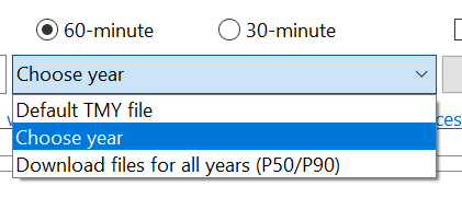
I used a weather file from the NREL National Solar Radiation Database (NSRDB) that I downloaded from SAM's Location and Resource page using the latitude and longitude from your file. You can use the Choose Year option to download a weather file for a specific year:
From Help: "The temperature correction algorithms use wind speed and ambient (dry-bulb) temperature data from the weather file, assumed to be measured at 2 meters above the ground. The heat transfer method also uses atmospheric pressure and wet-bulb temperature data."
Weather files from the NSRDB include atmospheric pressure, relative humidity, and dew-point temperature data in addition to ambient, which allows SAM to calculate the wet-bulb temperature.
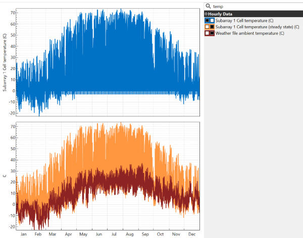
Here are results from the heat transfer method using an hourly weather file from the NSRDB for 2015 at latitude = 40.73 and longitude = -77.94 decimal degrees:
Best regards,
Paul.
I used a weather file from the NREL National Solar Radiation Database (NSRDB) that I downloaded from SAM's Location and Resource page using the latitude and longitude from your file. You can use the Choose Year option to download a weather file for a specific year:
From Help: "The temperature correction algorithms use wind speed and ambient (dry-bulb) temperature data from the weather file, assumed to be measured at 2 meters above the ground. The heat transfer method also uses atmospheric pressure and wet-bulb temperature data."
Weather files from the NSRDB include atmospheric pressure, relative humidity, and dew-point temperature data in addition to ambient, which allows SAM to calculate the wet-bulb temperature.
Here are results from the heat transfer method using an hourly weather file from the NSRDB for 2015 at latitude = 40.73 and longitude = -77.94 decimal degrees:
Best regards,
Paul.
Attachments:
Please Log in or Create an account to join the conversation.
Moderators: Paul Gilman