


- Posts: 6
How to verify the location of NSRDB Station
- Kyle Dean
- Topic Author
Less
More
20 May 2020 16:15 #8218
by Kyle Dean
How to verify the location of NSRDB Station was created by Kyle Dean
Hello,
I would like to know how I can look up information about the NSRDB site that SAM references when downloading a TMY weather file.
For example: when I geocode "O'donnell, Texas, USA", it downloads tmy file from NSRDB station 567326. Which has a lat long header, but I would like to verify the station through NSRDB itself.
When I lookup all the NSRDB stations, there are no station in texas that start with the number 5, they only start with 7?
rredc.nrel.gov/solar/old_data/nsrdb/1991-2005/tmy3/by_state_and_city.html
I would like to verify the class of data I am seeing from SAM.
can anyone provide some clarity on where these weather files are coming from?
Please Log in or Create an account to join the conversation.
- Paul Gilman
Less
More
- Posts: 5707
20 May 2020 16:56 - 20 May 2020 16:57 #8219
by Paul Gilman
Replied by Paul Gilman on topic How to verify the location of NSRDB Station
Hi Kyle,
SAM downloads data from the NSRDB PSM V3 dataset. The link you provided below is to a legacy data set called NSRDB MTS 2. Please see this page on the NSRDB website for more on the different NSRDB versions:
nsrdb.nrel.gov/about/u-s-data.html
The NSRDB PSM V3 data does not have the classes that were used with the MTS 2 data. The "station id" number for the PSM V3 actually identifies the map grid cell rather than a measurement station.
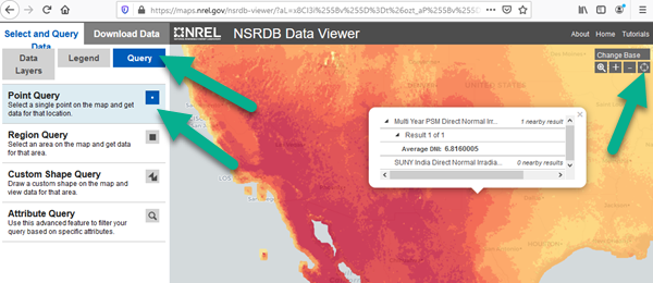
You can use the NSRDB Viewer to explore the PSM V3 data at nsrdb.nrel.gov/ .
Best regards,
Paul.
SAM downloads data from the NSRDB PSM V3 dataset. The link you provided below is to a legacy data set called NSRDB MTS 2. Please see this page on the NSRDB website for more on the different NSRDB versions:
nsrdb.nrel.gov/about/u-s-data.html
The NSRDB PSM V3 data does not have the classes that were used with the MTS 2 data. The "station id" number for the PSM V3 actually identifies the map grid cell rather than a measurement station.
You can use the NSRDB Viewer to explore the PSM V3 data at nsrdb.nrel.gov/ .
Best regards,
Paul.
Attachments:
Last edit: 20 May 2020 16:57 by Paul Gilman.
Please Log in or Create an account to join the conversation.
- Michael Wood
Less
More
- Posts: 1
03 Jan 2022 05:31 #10463
by Michael Wood
Replied by Michael Wood on topic How to verify the location of NSRDB Station
Hi Paul, it sounds like you're saying "station ID" refers to grid cell and not a physical sensor set.
1. Can we as NSRDB users interact at all with the raw physical sensor data? Or at least know how far a location of interest is from the nearest physical sensors?
2. In Sengupta et al 2017 "station" seems to refer to a physical sensor set. Can you help me understand when (in NSR or SAM parlance) station refers to the physical thing and when it instead refers to the grid cell? This is a bit confusing for us.
M
Please Log in or Create an account to join the conversation.
- Paul Gilman
Less
More
- Posts: 5707
03 Jan 2022 16:53 #10466
by Paul Gilman
Replied by Paul Gilman on topic How to verify the location of NSRDB Station
Hi Michael,
The NSRDB API returns a number in the "Location" field that identifies the NSRDB grid cell. This number does not represent a physical weather station. The Location and Resource page in SAM shows this number as "Station ID." I can see where that label is misleading -- it is left over from the very earliest NSRDB datasets where the number did represent a physical station.
In general, the solar irradiance data in an NSRDB weather file comes from satellite data as described in the Sengupta paper you cite and also in this general description: nsrdb.nrel.gov/about/what-is-the-nsrdb.html
Section 3.1.3 of the Sengupta paper below briefly mentions that the meteorological data (wind speed, surface temperature, etc.) come from NASA's MERRA-2 database. I'm not sure how to use that database to determine the source of the meteorological data for a particular location.
Best regards,
Paul.
Please Log in or Create an account to join the conversation.
Moderators: Paul Gilman